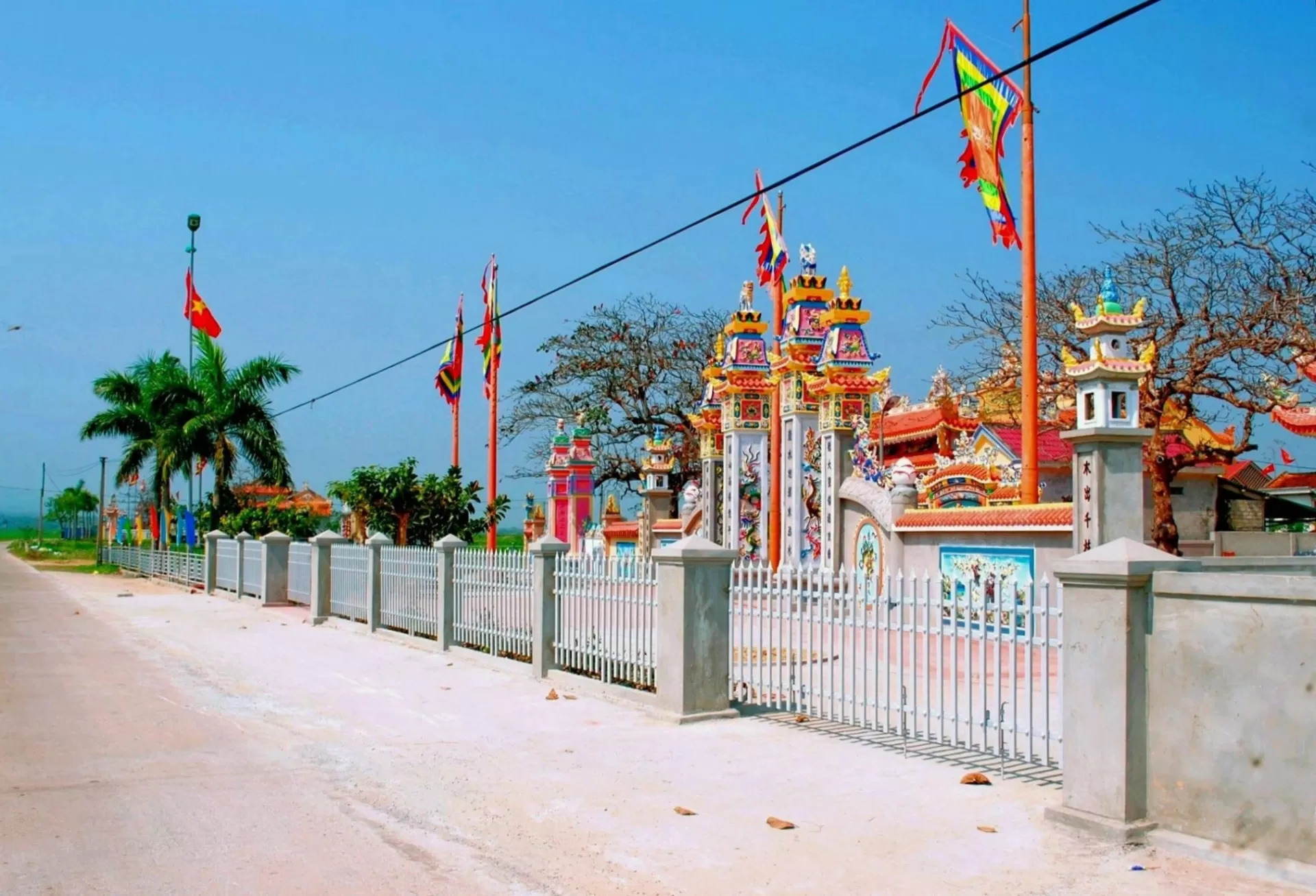
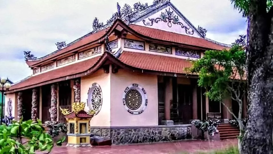
Cao Lạo Hạ village (also known as Kẻ Hạ village) is located in Hạ Trạch commune, Bố Trạch district, Quảng Bình province. In his poetic work Cao Lao Hương Sử (lit. History of Cao Lao), Lưu Trọng Tuần explains the name “Cao Lao” as follow:
“Cao Lao tiền thế đặt tên
Cao: trông vời vợi, Lao: bền không xiêu”
“Cao Lao, the name given by our forefathers
Cao: Far and Deep, Lao: Enduring and Upright”
F-rom an etymological standpoint, “Cao” in Cao Lao comes f-rom cao đẹp, cao cả (honorable). “Lao” means firm, solid and strong; it does not mean lao nhọc (strenuous, laborious).
The history and development of Cao Lao Hạ is strongly tied to that of Quảng Bình province, a sacrosanct part of our fatherland Vietnam. The land of Quảng Bình as we know nowadays has experienced many administrative changes in the past. The earliest records indcate that in the Hùng Vương era, present-day Quảng Bình belonged to Việt Thường prefecture, one of the 15 prefectures of ancient nation Văn Lang.
Early during the period of Chinese domination (111BC – 938AD), Quảng Bình was al-ternatively located in two Chinese prefectures Tường Lâm and Nhật Nam. In 192, Lâm Ấp nation in the South defeated the Chinese Hán army in Quảng Bình and annexed the province to its territory. In 758, Lâm Ấp was renamed Chiêm Thành; Quảng Bình belonged to two prefectures of Chiêm Thành: Bố Chính and Địa Lý.
Under the Lý dynasty in 1069, a Đại Việt army, in order to terminate a North-South collusion between the Tống (Tang) dynasty of China (North) and Chiêm Thành (South), passed through the Hoành Sơn mountain range and attacked Chiêm Thành. The army, led by King Lý Thánh Tông and General Lý Thường Kiệt, successfully captured King Chế Củ of Chiêm Thành. As a bail-out clause, Chế Củ offered three Chiêm Thành districts located in the south of the Hoành Sơn range: Bố Chính,1 Ma Linh and Địa Lý (present-day Quảng Bình and Quảng Trị). King Lý Thánh Tông accepted the offer; Quảng Bình once again returned to the fatherland Đại Việt.
In 1075, Lý Thường Kiệt renamed Bố Chinh district to Bố Chính, Địa Lý district to Lâm Bình and Ma Linh district to Minh Linh.2 It was Lý Thường Kiệt who laid the foundation for subsequent demographic, political and economic development in the region.
Together with the name changes, Lý Thường Kiệt recruited people of all classes in the North, ecouraged them to migrate southward and resettle in the three newly acquired districts. He also reorganized administrative systems in these districts in order to defend the south border against further Chăm aggresions. The resettlement process conformed with the contemporary Ngụ Binh Ư Nông (lit. Farmers being Hidden Warriors) policy of the Lý dynasty. Men and women were grouped into villages; under the Ngụ Binh Ư Nông policy, each village is not only an administrative unit but also a defense battalion should the war take place. It can be said that the history of development of the three districts, including Cao Lao Hạ village, started f-rom here.
Cao Lao Hạ village, according to some old legends, formed with these first waves of settlers during the Lý dynasty. However, according to familial annals kept by the oldest families in the region, Cao Lao Hạ village did not form until the late Lê dynasty, especially after another call for resettlement issued by King Lê Thánh Tông who wrote: “Bố Chính đất rộng người thưa, liền với châu Hoan, vậy quân và dân đến đó khẩn hoang sẽ có lợi lớn” (Bố Chính is a spacious land occupied by few people and bordered by Hoan district; enormous profits await settlers there).3 The call led to significant migration waves; many people left the four Northern disctricts to resettle in the south and in Bố Chính. The south bank of the Gianh river especially welcomed people f-rom Thanh – Nghệ who later established three Cao Lao villages: Cao Lao Thượng (also known as Kẻ Thạng), Cao Lao Trung (a.k.a. Kẻ Chuông) and Cao Lao Hạ (a.k.a. Kẻ Hạ).4 It can be infered f-rom how places were named that ancestors of Cao Lao people originate mainly f-rom Thanh – Nghệ – Tĩnh, because their dialect closely models that in Hoan Ái (Ô Châu Cận Lục, 1553). They arrived in Cao Lao around the late Lê dynasty (1460 – 1497); around 500 years have since passed. Written familial records indicate that resettlers, when migrating into Quảng Bình, often brought their whole family so the relocating process was smooth and fast. They usually chose fertile lands near river banks as their new homes.
Under Lord Nguyễn Hoàng’s regime (f-rom 1558 to 1604), Bố Chính district was divided into North Bố Chính and South Bố Chính. North Bố Chính lay to the north of the Gianh river; South Bố Chính lay to the south. North of the Gianh river was also called Đàng Ngoài (lit. Outer Territory); south of the Gianh river was called Đàng Trong (lit. Inner Territory). In 1605 Nguyễn Hoàng renamed Bố Chính district to Quảng Bình; the name Quảng Bình originates since then.
When Trịnh lord chased Nguyễn lord out of Thuận Hoá and Quảng Trị in 1776, Lê Quý Đôn, governor of Thuận Hoá and a renowned military adviser, documented in Phủ Biên Tạp Lục that: South Bố Chính district was composed of two counties (tổng): Trứ Lễ and Lương Xá. Trứ Lễ was composed of 17 communes (xã), 7 wards (phường), 6 quarters (trang) and included Cao Lao. He, however, agglomerated all three Cao Lao villages together and did not mention any one seperately.5
Nearly 200 years later, Nguyễn Huệ led the succesful Tây Sơn revolt against both Trịnh and Nguyễn lords and reunited the country. North Bố Chính and South Bố Chính were merged back into Thuận Chính district (Thuận means agreement, cooperation and the end of war).
In 1802, after defeating the Tây Sơn revolt and founding the Nguyễn dynasty, Nguyễn Phúc Ánh became king with reign title Gia Long, again divided Quảng Bình into Bố Chính nội (lit. Inner Bố Chính) and Bố Chính ngoại (lit. Outer Bố Chính) in order to impose different tax levels for people on different sides of the Gianh river.
According the familial annals of the Lê Quang family, under the Nguyễn (Gia Long) regime, in 1801, Lê Quang Hào, a fine man f-rom Cao Lao Hạ village, Thị Lễ county was appointed captain of the second squadron of the Vệ Chấn Võ force in the Trung Quân division of the royal army.6 As such, under the Gia Long reign title, Trứ Lễ had been renamed Thị Lễ; the exact time the name change occurred, however, is still unknown. Also according the the Lê Quang familial annals, in 1803, King Gia Long promoted Lê Quang Hào to the rank of “Mân Nhật Hầu”. In 1814, thanks to his significant contributions, Lê Quang Hào was again promoted. We know f-rom his appointment letter that Thị Lễ was again renamed Cao Lao.
In the third year of the Minh Mạng reign title (1822), South Bố Chính was simplified as Bố Chính. In the twelfth year of Ming Mạng, it was changed into Bố Trạch district, emcompassing five counties (tổng): Cao Lao, Liên Phương, Hoàn Lão, Hoàn Phúc and Hà Bạc. Cao Lao county was composed of 25 villages and wards, of which 3 villages bore the name “Cao Lao”: Cao Lao Thượng, Cao Lao Trung and Cao Lao Hạ.7 The reason for them bearing a common name is not yet clear.
In 1832, under the Minh Mạng regime, South Bố Chính recovered its old name Quảng Bình. Since then until the Thiệu Trị regime, Quảng Bình province is composed of two towns (phủ) and six districts (huyện) (phủ is made up of multiple huyện). The two towns are Quảng Ninh and Quảng Trạch. Quảng Ninh was composed of three districts: Phong Lộc, Phong Đăng and Lệ Thủy (Đồng Hới was part of Quảng Ninh). Quảng Trạch was composed of three districts: Bố Trạch, Bình Chánh and Minh Chánh.
Since the Cần Vương (lit. Aid the King) movement until 1945, Quảng Bình had two towns (phủ) and three districts (huyện) (now phủ does not encompass huyện). The two towns were: Quảng Ninh and Quảng Trạch; the three districts were: Lệ Thuỷ, Bố Trạch and Tuyên Hoá.
Cao Lao Hạ people believe that Lưu, Nguyễn and Lê were the first families to ressetle in the area. According to familial annals, ancestors of the Lưu, Nguyễn and Lê families were among the first to arrive in Cao Lao Hạ; they were: Lưu Văn Tiên, rank Đại Tướng Quân, Dực Bảo Trung Hưng Linh Phù Chi Thần, Nguyễn Văn Khai, rank Đại Tướng Quân Nguyễn Quý Công, and Lê Quang Lữ, rank Triệu Phong Lê Quý Công. They were the founders of Cao Lao Hạ village. The three ancestors are nowadays worshipped in the Lưu, Nguyễn and Lê family’s shrines (nhà thờ họ).
At about the same time with the above three founders, there are other families moving south and resettle in Cao Lao Hạ. The exact time these families resettled is not clear since their familial annals are missing. However, it is known that they have been in Cao Lao for around 15 generations and have all become significant families among the 24 families in present-day Cao Lao Hạ.
The ancestors, while resettling, had been naming new places they found. Ancestor of the Nguyễn family had named places including Kim Qui, Đồng Giôn, Đồng Léc, Đồng Bẫy, Đồng Ông Già, Đồng Ran, Đồng Rú, Cửa Nam, Bàu Hóc, Bàu Hào...; ancestor of the Lê Chiêu family named places such as Lòi Sắn, Khu Nại, Khu Vợt, Đồng Hưng... Ancestors of Lê Quang and Lê Chiêu families gave name to Cù Sơn, Cựa Cương, Múi Đới, Múi Bần, Cù Neo, Hói Đá, Chú Thanh, Chú Quỉ, Cồn Cui, Nội Bạn Trân, Nội Bạn Dưới, Bàu Mật, Bàu Gát, Bàu Dầu, Lẹm Hẹm...; ancestor of the Lưu family resettled and named places including Bàu Vuông, Bàu Gát Su, Bàu Gát Dưới, Bàu Cửa, Ông Vườn, Hói Cỗ... Most of the names have survived until modern days and have been serving as evidence of which family settled in which area originally.
Apart f-rom the above places, Cao Lao Hạ still has many places with names whose origin is unknown, suggesting that our understanding of the resettlement process still has many gaps due to the lack of records and to the loss of relevant documents. After 1945 there are records of new settlers who expanded the farm lands: Lưu Quí Ly (near Kim Qui), Tín (in Hói Đá).
After Cách Mạng Tháng Tám (the August Revolution), Democratic Republic of Vietnam was founded. Quảng Bình was composed of five districts (huyện): Lệ Thủy, Quảng Ninh, Bố Trạch, Quảng Trạch, Tuyên Hóa and one town (thị xã) Đồng Hới (f-rom 1965 until September 1975 Tuyên Hoá was splitted into two smaller districts Tuyên Hoá and Minh Hoá). When the August Revolution succeeded in 1945, in Cao Lao Hạ village temporary People’s government (chính quyền nhân dân lâm thời) was formed, initially called as Uỷ ban Nhân dân Cách mạng (Committee of Revolutionary People) and later changed to Uỷ ban Hành chính làng Cao Lao Hạ (Cao Lao Hạ Committee of Administration). Regardless of what it was called, the administrative system of Cao Lao Hạ village was always under the supervision of Ủy ban Hành Chính huyện Bố Trạch (Bố Trạch district Committee of Administration).
In 1947, the French colonized Quảng Bình. In June 1947, the administrative systems at all levels were asked to be restructured for more efficiency. The Committee for Revolution (Uỳ ban Kháng Chiến) was merged with the Committee of Administration (Uỷ ban Hành Chính) to form the Committee for Revolution and Administration, presided by Mr. Lưu Trọng Lạc (who is f-rom Cao Lao). Also, 22 villages (thôn) were merged into six communes (xã). Eight villages in the south of the Gianh river (Bồ Khê, Bồ Khê Phường, Thanh Bình, Thanh Bồ, Đặng Đề, Cao Lao Hạ, Cao Lao Trung, Cao Lao Thượng) together formed a new commune called Bắc Trạch. Bắc Trạch was an independent administrative unit with its own Hội đồng Nhân dân (People’s Committee), chi bộ Đảng (the Communist Party’s branch) etc. In June 1955, Bắc Trạch was splitted into four communes: Mỹ Trạch (ecompassing Cao Lao Trung, Cao Lao Thượng villages), Hạ Trạch (Cao Lao Hạ village), Bắc Trạch (Đặng Đề, Thanh Ba), and Thanh Trạch (Bồ Khê, Thanh Bồ).
In 1955, as part of a tax reduction plan, Cao Lao Hạ was divided into smaller villages (thôn) based on geographical features of the land. The names of these new villages all started with “Cao”: Cao Nam, Cao Thành, Cao Biền, Cao Xạ, Cao Đình, Cao Trường, Cao Lưu, Cao Đông, Cao Tây, Cao Đài, Cao Đức, Cao Phúc, Cao Đồng.
When the Land Reform (Cải cách ruộng đất) took place in 1956, land became publicly owned. Production teams (tổ sản xuất) and production cooperative (hợp tác xã) were cre-ated. Farm land was expanded to support bigger scale production. Over time, the cooperatives grew in size. Hạ Trạch had two large cooperatives: Thống Nhất and Trường Lưu. The cooperatives were administered by a management board (Ban điều hành hợp tác xã). The Committee of People (Uỷ ban Nhân Dân) was responsible for the administration.
In 1964, the administration in Hạ Trạch commune moved some people to Sen Bàng (Hoà Trạch commune, Bố Trạch district) to establish a new economic zone. In 1967, following guidelines of the Communist Party, the administration again moved people to near Lệ Đệ mountain. F-rom Mồ Côi cave to Mỹ Trung village (Mỹ Trạch commune), a new residential community was established called Làng Rẫy. Làng Rẫy is made up of 4 villages (thôn) (numbered 3, 4, 8 and 9). Some of these new villages were former villages of the cooperatives. Cooperative Thống Nhất had four villages; two were moved into Làng Rẫy (number 3 and 4); two were not (number 1 and 2). Cooperative Trường Lưu had five villages; two were moved into Làng Rẫy (number 8 and 9); three were not (number 5, 6 and 7). As such, nowadays, Hạ Trạch commune is composed of two main areas: the “old area” (with five villages that were not moved) and the Làng Rẫy area (with four villages that were moved).
Throughout many ups and downs of history, Cao Lao Hạ village has always survived and developed. It has become a beloved homeland for many generations.
The Vietnamese version of this article can be found here. (Xem bản tiếng việt tại đây)
__________________
1. “Đại Việt Sử Ký toàn thư”, Social Sciences Publishing House, 1972, p. 233
2. “Đại Việt Sử Ký toàn thư”, Social Sciences Publishing House, 1972, p. 237
3. Excerpt f-rom Nam Hạ letter
4. Dương Văn An, “Ô Châu Cận Lục”, Thuận Hoá Publishing House, 2001, p. 47. In a section on Đồ Bản, the author writes that Bố Chính district has 69 communes, including Cao Lao Thượng, Cao Lao Trung and Cao Lao Hạ.
5. Lê Quý Đôn, Social Sciences Publishing House, 1977, p. 83
6. The royal army under the Nguyễn regime is composed of five divisions. In wars, the Trung Quân division moves in the middle and is led directly by the King.
7. Cao Lao county: Bồ Khê xa, Bồ Khê phường, Thanh Bồ, Đặng Đề, Thanh Ba, Cao Lao Hạ, Cao Lao Trung, cao Lao thương, Phú Kinh, Phú Mỹ, Hà Môn, Thanh Lăng, gia Hưng, Gia tịnh, Xuận Sơn, Na, Trầm, Mé, Lim, Phong Nha, Hạ Lời, cù Lạc, Cù giang, Ngoại Hải, Xuân Hồi.